Title:
Evaluating the Causes of Land Subsidence on the U.S. Mid-Atlantic Coast Measured with InSAR
Poster
Preview Converted Images may contain errors
Abstract
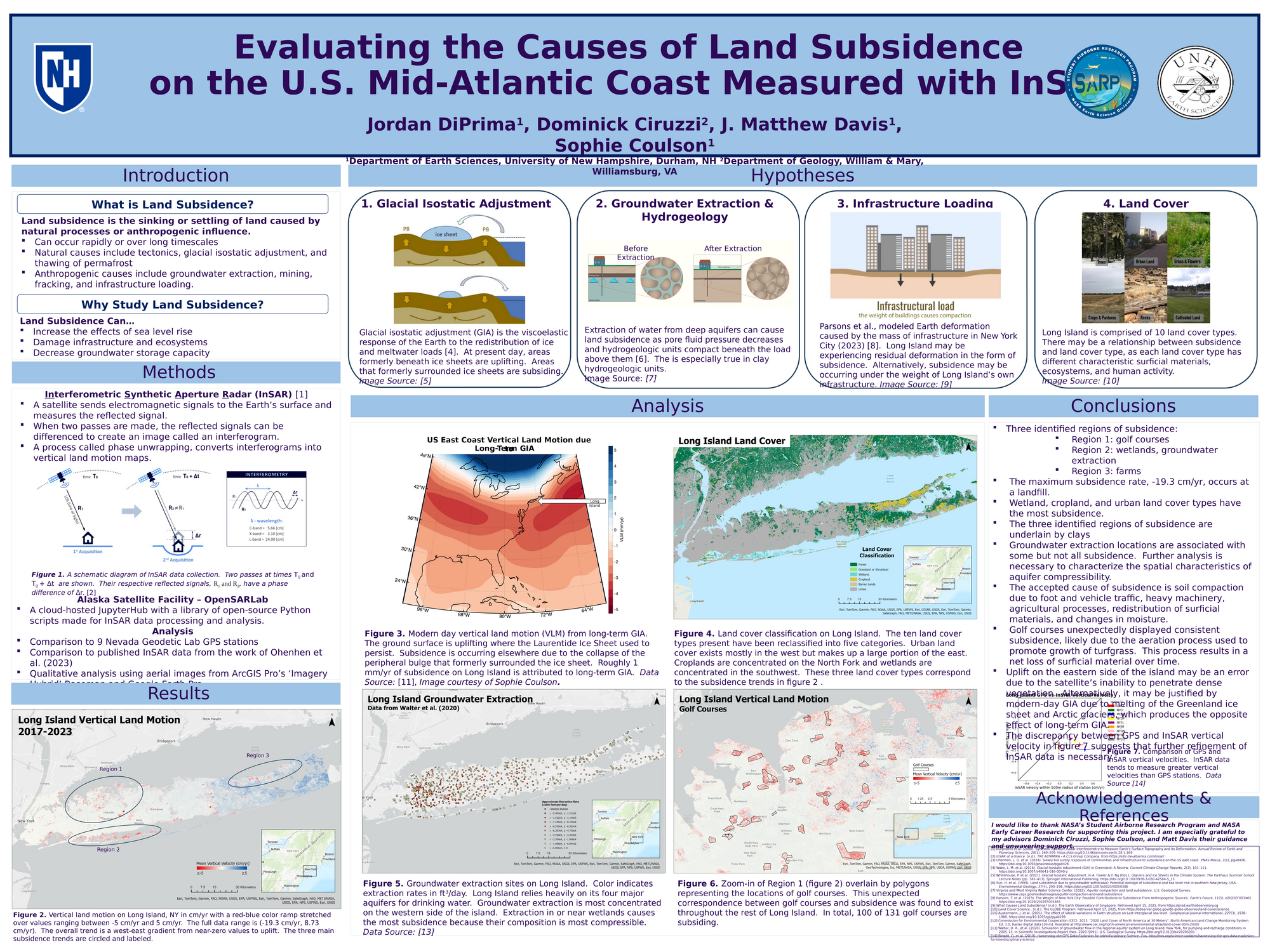
Land subsidence is a frequently overlooked geologic hazard that is caused by natural processes and anthropogenic stressors. The goal of this study is to quantify vertical land motion (VLM) on Long Island, New York and evaluate the potential causes of subsidence. The causes considered are glacial isostatic adjustment, groundwater extraction, infrastructure loading, and land cover. This study utilizes interferometric synthetic aperture radar (InSAR) satellite data to calculate linear VLM trends from 2017 to 2023. Datasets for each hypothesis were qualitatively compared to VLM results. Subsidence rates were found to be anthropogenic and associated with golf courses, farms, wetlands, cemeteries, and landfills. The accepted cause of subsidence is soil compaction due to stressors like foot and vehicle traffic, farming processes, and moisture changes in surficial materials. For golf courses, the aeration process is thought to play a role. There was found to be a relation between land cover and subsidence. Additionally, results suggest that groundwater extraction facilitates subsidence, especially in wetlands. Comparison of results to GPS data and a published VLM dataset suggests that further refinement of InSAR data is necessary to improve confidence in this study’s findings.
Authors
| First Name |
Last Name |
|
Jordan
|
DiPrima
|
Leave a comment
Submission Details
Conference URC
Event Interdisciplinary Science and Engineering (ISE)
Department Earth and Environment Sciences (ISE)
Group Earth and Environment Sciences
Added April 20, 2025, 11:45 a.m.
Updated April 20, 2025, 11:46 a.m.
See More Department Presentations Here