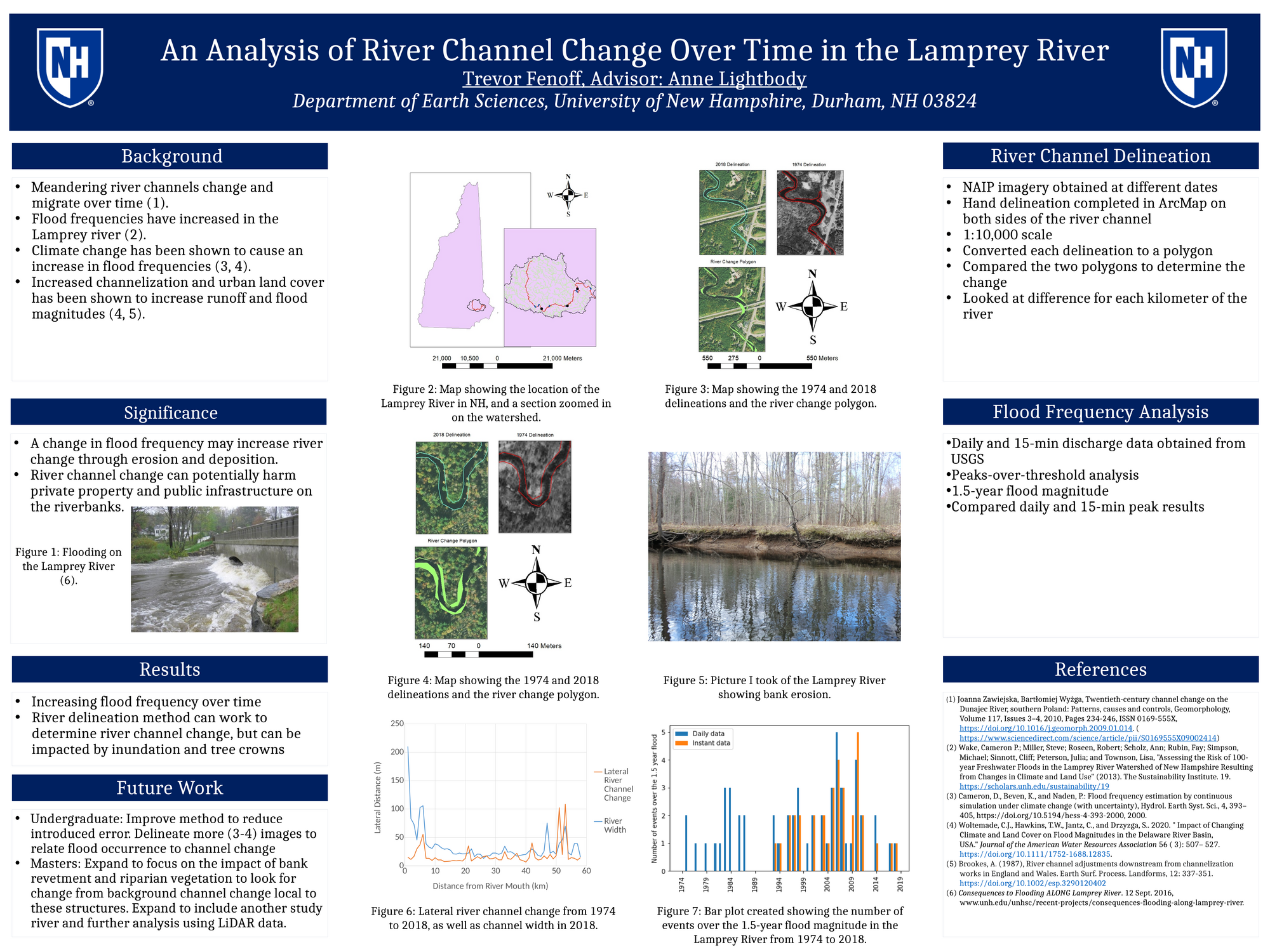
This project aims to determine the relationship between flood events and river channel change through aerial imagery analysis and a peaks-over-threshold flood analysis. Historical aerial imagery from different dates will have each bank hand delineated. These delineations will then be compared to each other to estimate river channel change within the Lamprey over time. Using a peaks-over-threshold flood frequency analysis with the 1.5-year recurrence interval as the peak, flooding events will be counted to relate river channel change to flooding events.
Authors
First Name
Last Name
Trevor
Fenoff
File Count: 1
Leave a comment
Submission Details
Conference URC
Event Interdisciplinary Science and Engineering (ISE)