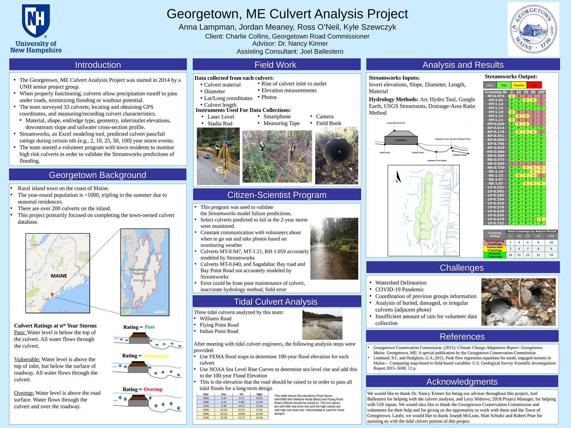
The purpose of the Georgetown, ME Culvert Analysis Project is to continue adding measurements and flow capacity analyses to the current culvert inventory for Georgetown. This research and analysis project was started in 2014 by a UNH Senior Project group and is continued now with Georgetown Road Commissioner Charlie Collins as primary client, and UNH professor Dr. Nancy Kinner as faculty advisor. If functioning properly, culverts allow precipitation runoff to pass under roads, minimizing flooding or washout potential. The team surveyed 33 culverts on Marrtown, Harmons Harbor, Loop, North End, and Kennebec Point Roads. Seniors were tasked with locating culverts, obtaining GPS coordinates of each culvert, and measuring and/or recording culvert characteristics. These characteristics include material, shape, end and edge type, diameter, length, inlet and outlet elevations, the slope downstream of the culvert, and a tailwater cross-section profile. After obtaining this data, the team used an Excel modeling tool called Streamworks for analysis. Streamworks reports whether each culvert will pass or fail certain storm events. The team found that culverts varied in the degree to which they failed, with some failing to pass smaller storm events and some being adequately sized to handle even large flows. The team also continued a citizen scientist monitoring program to take photos of culverts at a 2-year event in order to validate the Streamworks model with real world data. The model was validated for several of the selected culverts but was not validated for others. The team also conducted a meeting with two Maine based engineers about the possibility of modeling tidal culverts. Because tidal culverts have two-way flow, they cannot be modeled using Streamworks. In the meeting with these engineers, the team learned that FEMA flood maps in conjunction with NOAA Sea Level Rise Curves are used to determine the elevation of roads in tidal zones. This analysis was completed for two tidal culverts on Williams Road and Flying Point Road.
Authors
First Name
Last Name
Kyle
Szewczyk
Ross
O'Neil
Jordan
Meaney
Anna
Lampman
File Count: 3
Leave a comment
Submission Details
Conference URC
Event Interdisciplinary Science and Engineering (ISE)
Department Civil and Environmental Engineering (ISE)