Title:
Using UAVs for Ocean Data Collection
Poster
Preview Converted Images may contain errors
Abstract
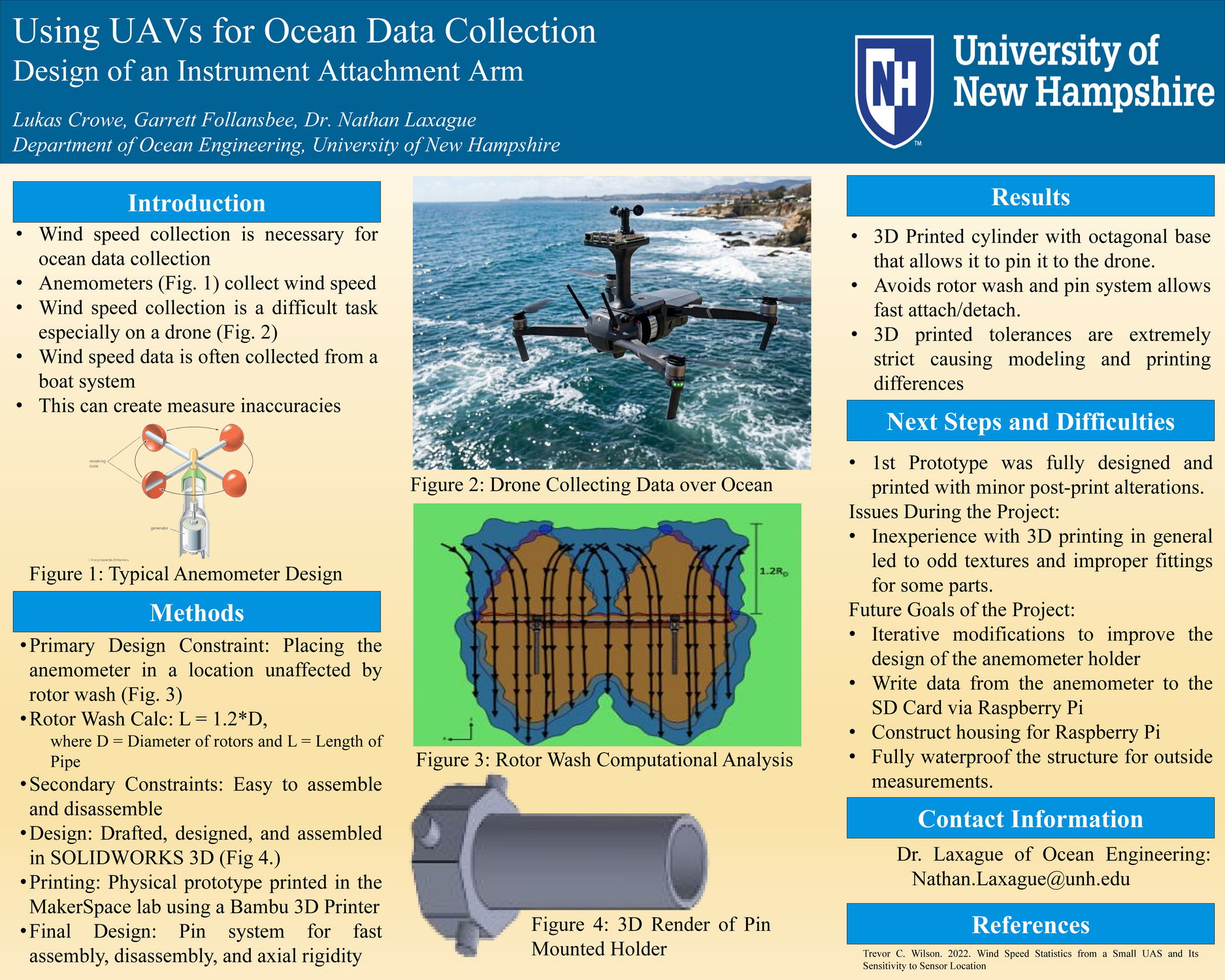
The purpose of this project is to work towards proving the viability of drone-based wind speed measurement systems for use in open ocean environments. Our main accomplishment for this project was the creation of a prototype anemometer holder that allowed for quick attachment and detachment, and it prevents rotor wash from interfering with measurements. The results of this project indicated that the best location for the placement of the anemometer was in the z-axis as opposed to the y-axis, with rotor wash affecting measurement for 5x the distance in the y-axis versus the z-axis (1.2 rotor diameters vs. 6 rotor diameters). If further testing and experimentation is done on this method, it may lead to a revolution in the way oceanographic wind speed data is measured, leading to more accurate models of oceanographic conditions at small scale locations.
Authors
| First Name |
Last Name |
|
Garrett
|
Follansbee
|
|
Lukas
|
Crowe
|
Advisors:
| Full Name |
|
Matthew Florence
|
|
Nathan Laxague
|
Leave a comment
Submission Details
Conference URC
Event Interdisciplinary Science and Engineering (ISE)
Department Innovation Scholars (ISE)
Group Innovation Scholars
Added April 20, 2026, 4:12 p.m.
Updated April 20, 2026, 4:12 p.m.
See More Department Presentations Here