Title:
Analyzing Forest Fires in New England: GIS-Based Assessment of Causes, Impacts, and Economic Challenges
Poster
Preview Converted Images may contain errors
Abstract
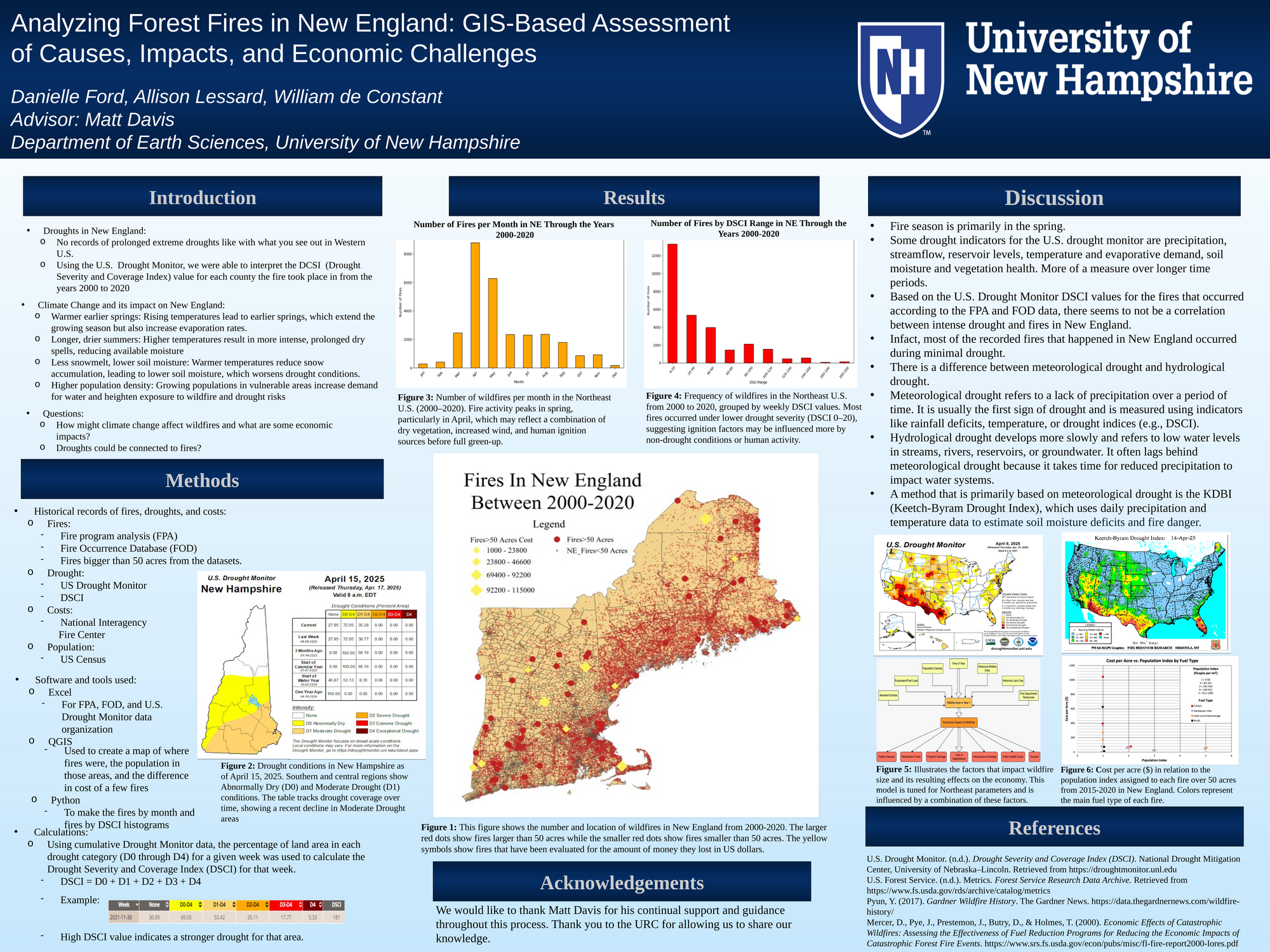
This study investigates the relationship between forest fires, drought conditions, and climate change in New England from 2000 to 2020 using GIS-based methods and historical datasets. Although New England does not experience the prolonged droughts typical of the western U.S., the region is increasingly affected by shorter-term drought episodes and warmer climate trends, which may contribute to wildfire risk. Utilizing data from the U.S. Drought Monitor, Fire Program Analysis, Fire Occurrence Database, and U.S. Census, we analyzed the frequency, timing, and severity of wildfires in relation to drought conditions categorized by the Drought Severity and Coverage Index (DSCI). Spatial and temporal patterns were visualized in GIS to assess fire occurrence and potential drivers. Results indicate that most fires occurred in the spring and were generally not strongly correlated with high drought severity, suggesting that factors such as vegetation, human activity, and meteorological variability play a more significant role. Economic impacts were also explored by evaluating suppression costs and fire distribution. Our findings highlight the complexity of fire dynamics in the Northeast and suggest the need for region-specific fire management strategies that account for non-drought-related influences.
Authors
| First Name |
Last Name |
|
William
|
deConstant
|
|
Allison
|
Lessard
|
|
Danielle
|
Ford
|
Leave a comment
Submission Details
Conference URC
Event Interdisciplinary Science and Engineering (ISE)
Department Earth and Environment Sciences (ISE)
Group Earth and Environment Sciences
Added April 21, 2025, 4:14 p.m.
Updated April 21, 2025, 4:15 p.m.
See More Department Presentations Here