Title:
Augmenting Landmarks on Electronic Navigational Charts Using Real-Time 3D Gaussian Splatting
Poster
Preview Converted Images may contain errors
Abstract
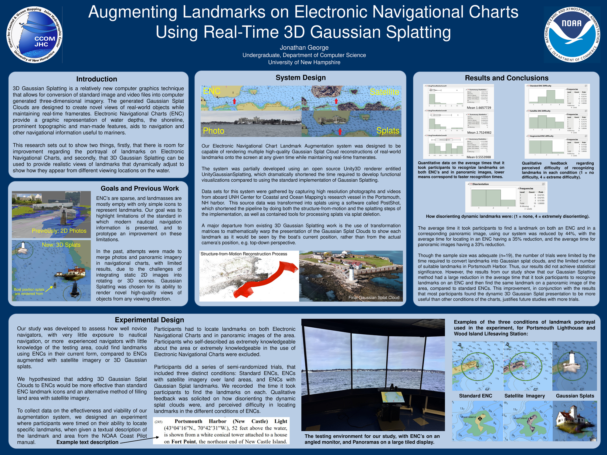
3D Gaussian Splatting is a relatively new computer graphics technique that allows for conversion of standard image and video files into computer generated three-dimensional imagery. The generated Gaussian Splat Clouds are designed to create novel views of real-world objects while maintaining real-time framerates. Electronic Navigational Charts (ENC) provide a graphic representation of water depths, the shoreline, prominent topographic and man-made features, aids to navigation and other navigational information useful to mariners.
This research sets out to show two things, firstly, that there is room for improvement regarding the portrayal of landmarks on Electronic Navigational Charts, and secondly, that 3D Gaussian Splatting can be used to provide realistic views of landmarks that dynamically adjust to show how they appear from different viewing locations on the water.
Authors
| First Name |
Last Name |
|
Jonathan
|
George
|
Leave a comment
Submission Details
Conference URC
Event Interdisciplinary Science and Engineering (ISE)
Department Computer Science (ISE)
Group Data Science
Added April 18, 2025, 12:49 p.m.
Updated May 10, 2025, 11:27 a.m.
See More Department Presentations Here