Title:
Beach Profile Mapping From Unmanned Aerial Vehicle Imagery
Poster
Preview Converted Images may contain errors
Abstract
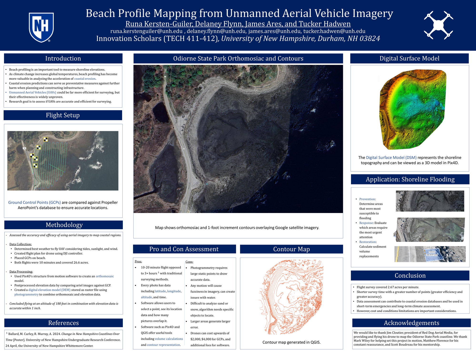
As global temperature increases, beach profiling, used to gather shoreline elevation data, has become vital to studying and predicting patterns of coastal erosion. Current methods of beach profiling are very time consuming and labor intensive, as one must map the area using a handheld GPS device. Unmanned Ariel Vehicles (UAVs) provide a solution to this problem as they can survey larger areas in a shorter time. However, their efficacy in beach surveying has yet to be seen. UAVs can take hundreds of pictures, and using a process called photogrammetry, these pictures are stitched together to create a Digital Elevation Map. We examined the accuracy and efficacy of using UAVs to survey coastlines. To test this, we conducted survey flights of a beach in Odiorne State Park using a DJI drone, as well as 5 GPS Ground Control Points (GCPs), which are used in post-processing as points of absolute location certainty. We were able to survey at a rate of 2.67 acres per minute, which is exceedingly faster than traditional methods that can take 2-3 hours surveying the area of one football field (1.32 acres). After flying, the images captured were imported into Pix4D, a software program that uses photogrammetry to create elevation map. The elevation data was found to be accurate to 1 inch. The elevation data can be used to identify areas most susceptible to flooding and to calculate volumes of areas, which can further the study of costal erosion. This newer technique of beach profiling could be used more frequently and would effectively simplify the shoreline data collection.
Authors
| First Name |
Last Name |
|
Tucker
|
Hadwen
|
|
Delaney
|
Flynn
|
|
Runa
|
Kersten-Guiler
|
|
James
|
Ares
|
Leave a comment
Submission Details
Conference URC
Event Interdisciplinary Science and Engineering (ISE)
Department Innovation Scholars (ISE)
Added April 22, 2024, 1:50 p.m.
Updated April 22, 2024, 1:50 p.m.
See More Department Presentations Here