Title:
Roads of the Sea
Poster
Preview Converted Images may contain errors
Abstract
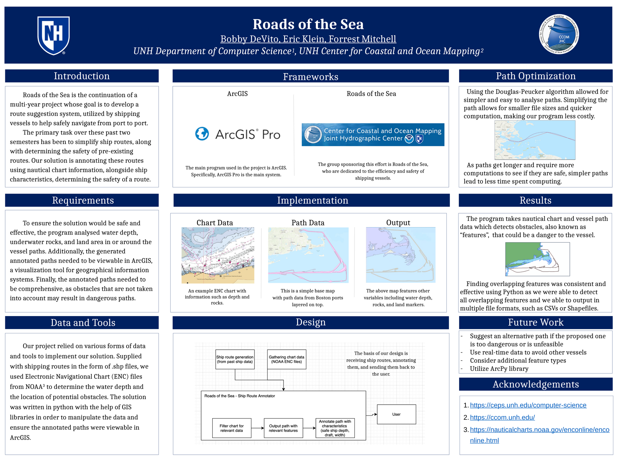
Large shipping vessels can have a hard time finding safe and efficient routes from one location to another, especially if the vessel is new to this route. This issue is amplified due to an abundance of other vessels in the water, large depths required to hold a vessel of that size, and underwater obstacles that are not directly visible. Building off work from the previous year that generates feasible shipping routes, this program will simplify the ship paths and annotate these routes, providing useful information about features that may pose a danger to the ship. First, the ship path is simplified using the Douglas-Peucker algorithm, which allows for quicker and easier computations. Then, the program filters on a list of specific features such as land area, underwater rocks, water depth, etc. Once those tasks are complete, files containing the simplified path and all of the overlapping features are outputted for numerical and visual analysis. The goal of this tool is to allow nautical vessels to detect potentially dangerous areas, which allows the users to make well-informed decisions and find safer routes. Results show that our outputs match what is expected for overlapping features in our testing regions.
Authors
| First Name |
Last Name |
|
Forrest
|
Mitchell
|
|
Eric
|
Klein
|
|
Bobby
|
DeVito
|
Leave a comment
Submission Details
Conference URC
Event Interdisciplinary Science and Engineering (ISE)
Department Computer Science (ISE)
Group Data Science
Added April 12, 2023, 4:10 p.m.
Updated April 12, 2023, 4:11 p.m.
See More Department Presentations Here