Title:
Estimating historical river channel change in New England
Poster
Preview Converted Images may contain errors
Abstract
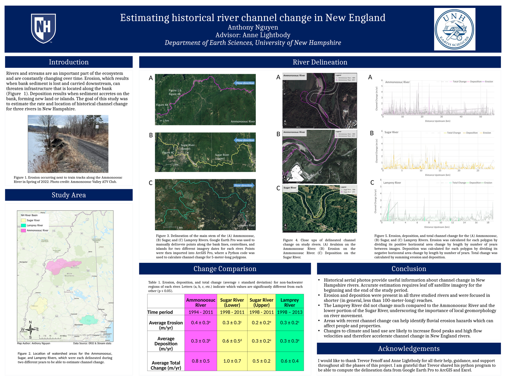
Rivers and streams are an important part of the ecosystem and are constantly changing over time. The goal of this study was to estimate the rate and location of historical channel change for three rivers in New Hampshire. In Google Earth Pro, I delineated the surface area of the Ammonoosuc, Lamprey, and Sugar Rivers from historical georeferenced aerial photographs at two different dates during fall or winter. ArcGIS was used to compare the bank position of the same river over time. which allowed me to calculate erosion and deposition. Erosion and deposition were present in all three studied rivers and were focused in shorter (in general, less than 100-meter-long) reaches. The Lamprey River did not change much compared to the Ammonoosuc River and the lower portion of the Sugar River, underscoring the importance of local geomorphology on river movement. Areas with recent channel change can help identify fluvial erosion hazards which can affect people and properties. Changes to climate and land use are likely to increase flood peaks and high flow velocities and therefore accelerate channel change in New England rivers.
Authors
| First Name |
Last Name |
|
Anthony
|
Nguyen
|
Leave a comment
Submission Details
Conference URC
Event Interdisciplinary Science and Engineering (ISE)
Department Earth Sciences (ISE)
Added April 18, 2022, 4:04 p.m.
Updated April 18, 2022, 4:05 p.m.
See More Department Presentations Here