Title:
PiRail
Poster
Preview Converted Images may contain errors
Abstract
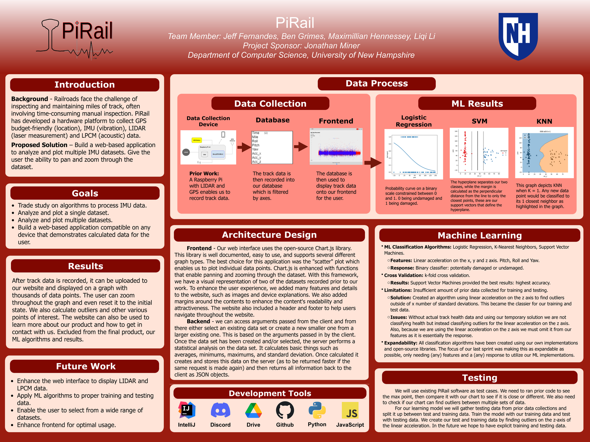
The railroad industry goes through a time consuming and dreadful process of maintaining the railways to be smooth and safe for its riders. Most of this process consists of measuring the many miles of track to make sure they’re consistently even throughout. To solve this issue, PiRail uses LIDAR technology and GPS coordinates connected to a Raspberry Pi to record data points to evaluate potential hazards off the track. Our software analyzes the data points into outliers, standard deviations, and averages along various axis both linearly and rotationally. PiRail greatly reduces maintenance time for workers, leaving more time for off-site work, and more time for open railways. Additionally, PiRail gives the user a simple and easy-to-use web-based platform to retrieve and analyze the recorded dataset. This platform gives visual information at the users requested coordinates, while also calculating outliers on the track where maintenance may be useful. PiRail looks to enable workers to accomplish more in a reduced period of time.
Authors
| First Name |
Last Name |
|
Maximillian
|
Hennessey
|
|
Benjamin
|
Grimes
|
|
Liqi
|
Li
|
|
Jeffrey
|
Fernandes
|
Leave a comment
Submission Details
Conference URC
Event Interdisciplinary Science and Engineering (ISE)
Department Computer Science (ISE)
Group Data Science
Added April 18, 2022, 1:20 a.m.
Updated April 19, 2023, 10:39 a.m.
See More Department Presentations Here