Title:
Investigation of Harvard Forest, MA Biometrics Utilizing Airborne LiDAR Data
Poster
Preview Converted Images may contain errors
Abstract
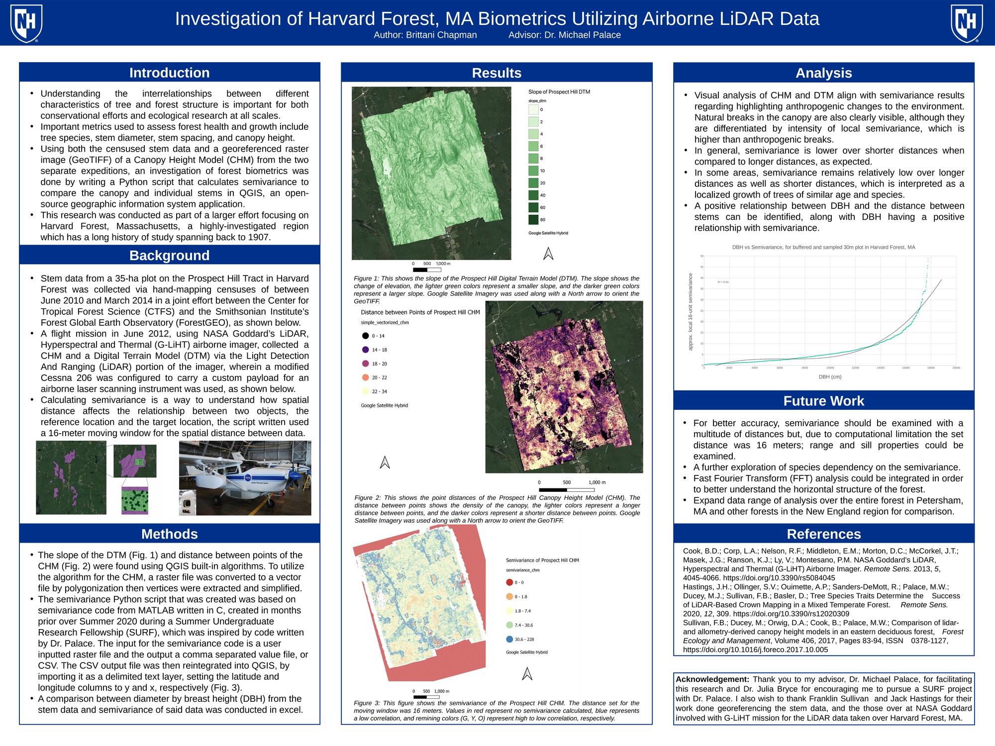
Understanding the interrelationships between different characteristics of tree and forest structure is important for conservational efforts and ecological research. There are many biometrics for assessing such structures, including canopy height, stem diameter, species assemblages, and tree spacing. An investigation of forest canopy height and stem diameter in Harvard Forest, Massachusetts was done via a census between June 2010 and March 2014 in a joint effort between Center for Tropical Forest Science (CTFS) and the Smithsonian Institute’s Forest Global Earth Observatory (ForestGEO) creating an index of stem data, and in June 2012 using Light Detection and Ranging (LiDAR) data from NASA Goddard’s LiDAR, Hyperspectral and Thermal (G-LiHT) airborne imager. Using both the censused stem data and a georeferenced raster image (GeoTIFF) of Canopy Height Model (CHM) from the two separate expeditions, an investigation of forest biometrics was done by writing a Python script that calculates semivariance to compare the canopy and individual stems in QGIS, an open-source geographic information system application.
Authors
| First Name |
Last Name |
|
Brittani
|
Chapman
|
Leave a comment
Submission Details
Conference URC
Event Interdisciplinary Science and Engineering (ISE)
Department Earth Sciences (ISE)
Added April 26, 2021, 8:54 a.m.
Updated April 26, 2021, 8:55 a.m.
See More Department Presentations Here