Title:
Mercury Concentrations in Estuarine Sediments of Maryland's Eastern Shore
Poster
Preview Converted Images may contain errors
Abstract
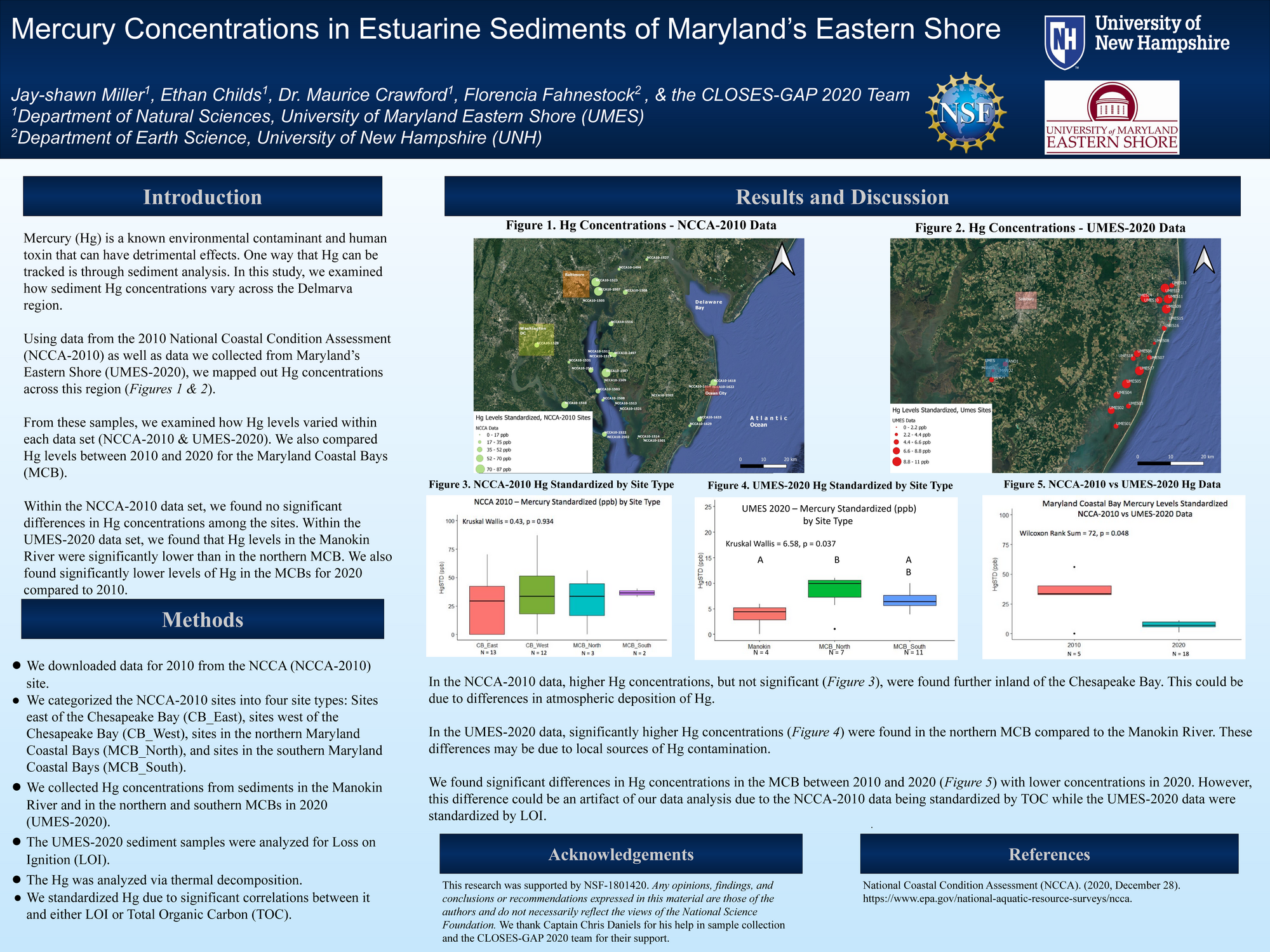
Using data from the 2010 National Coastal Condition Assessment (NCCA-2010) as well as data we collected from Maryland’s Eastern Shore (UMES-2020), we mapped out Hg concentrations across this region (Figures 1 & 2).
From these samples, we examined how Hg levels varied within each data set (NCCA-2010 & UMES-2020). We also compared Hg levels between 2010 and 2020 for the Maryland Coastal Bays (MCB).
Within the NCCA-2010 data set, we found no significant differences in Hg concentrations among the sites. Within the UMES-2020 data set, we found that Hg levels in the Manokin River were significantly lower than in the northern MCB. We also found significantly lower levels of Hg in the MCBs for 2020 compared to 2010.
Authors
| First Name |
Last Name |
|
CLOSES-GAP 2020
|
TEAM
|
|
Florencia
|
Fahnestock
|
|
Maurice
|
Crawford
|
|
Ethan
|
Childs
|
|
Jay-shawn
|
Miller
|
Leave a comment
Submission Details
Conference URC
Event Interdisciplinary Science and Engineering (ISE)
Department Earth Sciences (ISE)
Added April 26, 2021, 1:54 a.m.
Updated April 26, 2021, 10:19 a.m.
See More Department Presentations Here