Title:
UAVs for Snow Mapping in Tuckerman Ravine
Poster
Preview Converted Images may contain errors
Abstract
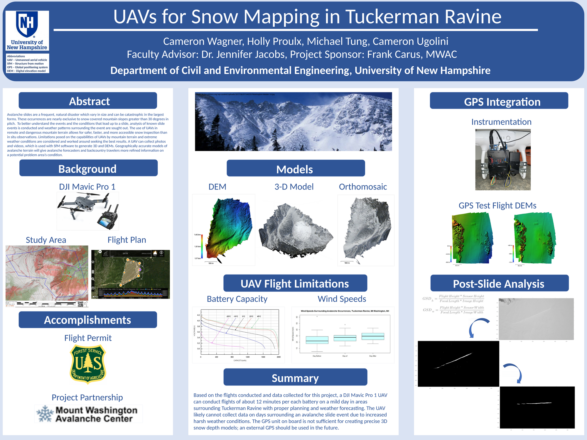
Avalanche slides are a frequent, natural disaster which vary in size and can be catastrophic in the largest forms. These occurrences are nearly exclusive to snow covered mountain slopes greater than 30 degrees in pitch. To better understand the events and the conditions that lead up to a slide, analysis of known slide events is conducted and weather patterns surrounding the event are sought out. The use of unmanned aerial vehicles (UAVs) in remote and dangerous mountain terrain allows for safer, faster, and more accessible snow inspection than in situ observations. Limitations posed on the capabilities of UAVs by mountain terrain and extreme weather conditions are considered and worked around seeking the best results. A UAV can collect photos and videos, which is used with a structure from motion (SfM) software to generate 3D and digital elevation models (DEM). Geographically accurate models of avalanche terrain will give avalanche forecasters and backcountry travelers more refined information on a potential problem area’s condition.
Authors
| First Name |
Last Name |
|
Cameron
|
Ugolini
|
|
Michael
|
Tung
|
|
Cameron
|
Wagner
|
|
Holly
|
Proulx
|
Leave a comment
Submission Details
Conference URC
Event Interdisciplinary Science and Engineering (ISE)
Department Civil and Environmental Engineering (ISE)
Group Research
Added April 26, 2021, 12:07 a.m.
Updated April 26, 2021, noon
See More Department Presentations Here