Title:
U.S. Military Housing Repair Cost Analysis
Poster
Preview Converted Images may contain errors
Abstract
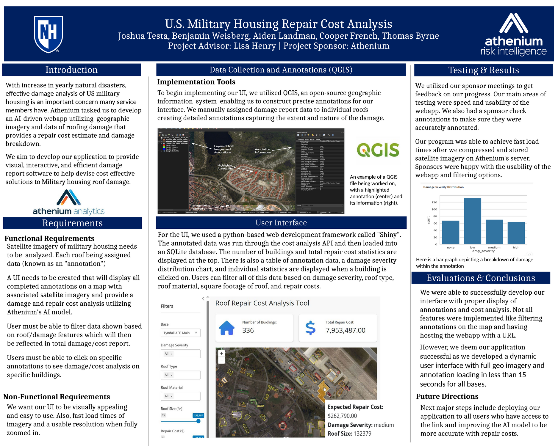
Military housing infrastructure faces ongoing challenges due to environmental damage, aging structures, and inadequate maintenance assessments. These issues pose safety risks to service members and their families, requiring efficient and accurate damage analysis to support budget optimization and timely repairs. Our project addresses this need by leveraging satellite imagery, AI-powered computer vision, and cost estimation algorithms to evaluate roof damage across military bases.
�Using QGIS, we annotate satellite images to identify damage, which is then processed into structured datasets. These datasets are uploaded into an interactive web interface built with Shiny, allowing users to filter and analyze damage reports by severity, roof type, and repair costs. The system integrates Athenium’s gauge damage API to generate repair cost estimates with a 10% margin of error, providing actionable insights for decision-makers.
By enhancing damage assessment efficiency, this project enables faster, data-driven repair planning for military housing. Future improvements will focus on deploying the application at scale and refining AI models for even greater accuracy in cost predictions.
Authors
| First Name |
Last Name |
|
Joshua
|
Testa
|
|
Cooper
|
French
|
|
Aiden
|
Landman
|
|
Benjamin
|
Weisberg
|
|
Tommy
|
Byrne
|
Leave a comment
Submission Details
Conference URC
Event Interdisciplinary Science and Engineering (ISE)
Department Computer Science (ISE)
Group Data Science
Added April 21, 2025, 11:10 a.m.
Updated April 21, 2025, 11:11 a.m.
See More Department Presentations Here