Title:
Roads of the Sea 23-24
Poster
Preview Converted Images may contain errors
Abstract
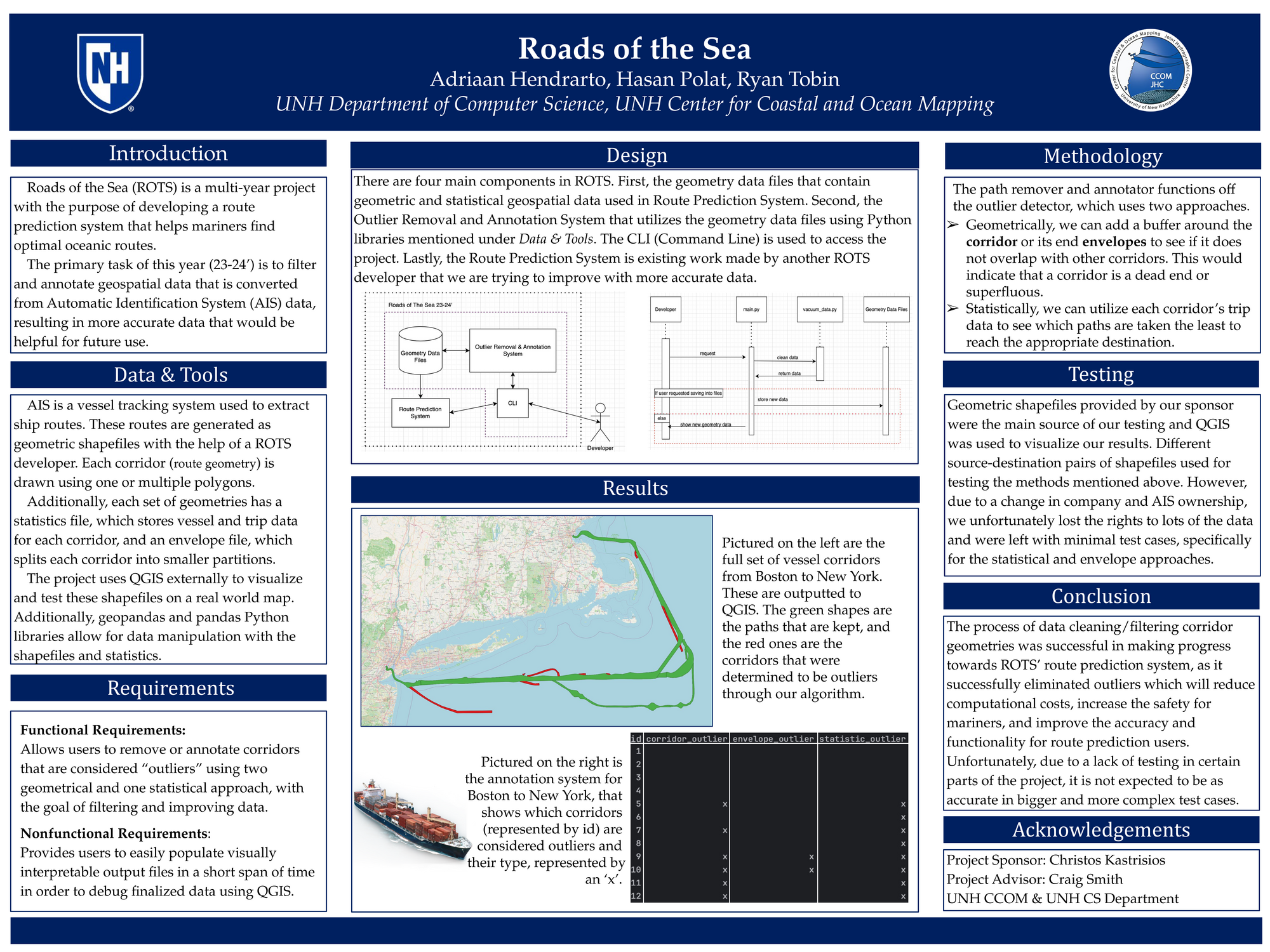
The Roads of the Sea Project maps vessel corridors – generalized geometric representations of individual paths taken by maritime vessels. These corridors will eventually be used to make decisions about which path to take for a certain ship based on its specific qualities and its destination. In order to optimize this eventual, larger predictive program, and cut down on computational costs, the original geospatial data needs to be cleaned.
The 23-24 group for this project has created a model that automatically strips outliers – corridors that are either designated as dead ends or host a statistically insignificant number of ships. To make these designations, multiple detection methods have been created – two of which utilize the geometries and geospatial data, and one that looks at each corridor’s vessel statistics. The model takes in the data files and detects corridors that fit each method’s specific outlier criteria. Within the available test cases, the model successfully removed several outliers with an annotation system created to specify and record each outlier’s type. The model, using a combination of these outlier detection methods, produced results that generalize the paths without removing valuable information that will be used in the eventual route prediction system.
Authors
| First Name |
Last Name |
|
Hasan
|
Polat
|
|
Ryan
|
Tobin
|
|
Adriaan
|
Hendrarto
|
Leave a comment
Submission Details
Conference URC
Event Interdisciplinary Science and Engineering (ISE)
Department Computer Science (ISE)
Group Data
Added April 17, 2024, 2:28 p.m.
Updated April 17, 2024, 2:28 p.m.
See More Department Presentations Here