Title:
Analyzing the Rate of Historical River Change in New England
Poster
Preview Converted Images may contain errors
Award:
Honorable Mention
Abstract
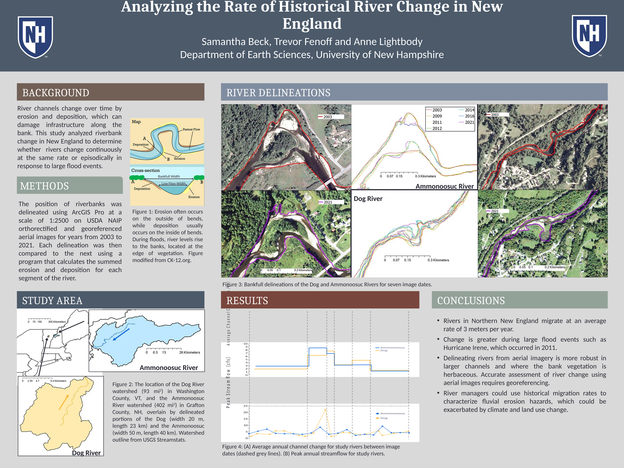
River channels change as a result of erosion and deposition, which can threaten infrastructure along riverbanks. Erosion is the process in which sediment is removed from the bank due to high-flow currents and moved down the river. Deposition is when sediment in the river is deposited along the bank or creates islands. This study examined how the Ammonoosuc and Dog Rivers in New England changed over time with the goal of determining whether these gravel-bed rivers changed continuously and/or episodically. The position of riverbanks was delineated using ArcGIS Pro at a scale of 1:2500 on USDA NAIP orthorectified and georeferenced aerial images from 2003 to 2021. Each delineation was then compared to the next using a program that calculated the summed erosion and deposition for each segment of the river. The river channels moved 3 m/yr on average. In addition, river channel change increased during large flood events such as Hurricane Irene in 2011. These findings can be used by river managers to characterize and mitigate fluvial erosion hazards.
Authors
| First Name |
Last Name |
|
Samantha
|
Beck
|
Leave a comment
Submission Details
Conference URC
Event Interdisciplinary Science and Engineering (ISE)
Department Earth Sciences (ISE)
Added April 17, 2023, 3:48 p.m.
Updated April 17, 2023, 5:16 p.m.
See More Department Presentations Here